blah blah blah
Mt. Flagg
Length: 6.2 miles out-and-backDifficulty (click for info): Hard
Elevation Gain: 1930 feet (+440 feet on return)
Rating (click for info): 7/10
Elevation: 2390'
Prominence: 140'
Driving Directions:
Trailhead and parking area are on Bents Road in Ossipee, NH (summits are in Tuftonboro). From Rt. 16, get off the ramp to the southern end of the concurrency with Rt. 25 (toward Rt. 25 eastbound). Turn southwest, following signs toward Center Ossipee Village, and turn right onto Old Route 16B in 0.1 miles. Continue 0.5 miles and turn left onto Folsom Road. In 0.3 miles, turn right onto Moultonville Road. Drive 1.5 miles, then fork right onto Valley Road. In 1.7 miles, turn right onto Bents Road. In another 0.4 miles, turn right into the parking area, an unmarked dirt road with a gate 150 feet in. Park near, but do not block, the gate. Click here for a Google map.
About the Hike:
NOTICE: The Sentinel Mountain Trail has been destroyed by logging. It is unknown if or when it will be reconstructed. The route as described below can no longer be followed. Please consult another source for alternate routes to Mt. Flagg and Sentinel Mountain.
Mt. Flagg is a sharp, rocky summit on an eastern ridge of Mt. Shaw in the Ossipee Mountains. Located within the extensive network of unofficial trails in the eastern Ossipees, ledges below the summit provide panoramic and far-reaching views of the Lakes Region. The ridge leading to the east from Mt. Flagg leads over the wooded summit of Canaan Mountain to another steep, ledgy summit, Sentinal Mountain, which rises from the northern shore of Dan Hole Pond. Several hiking trails cross the scenic ridge and provide access to the viewpoints on Flagg and Sentinal. Both summits are recognized on the Ossipee 10 hiking list as two of the most scenic destinations in the Ossipee Range.
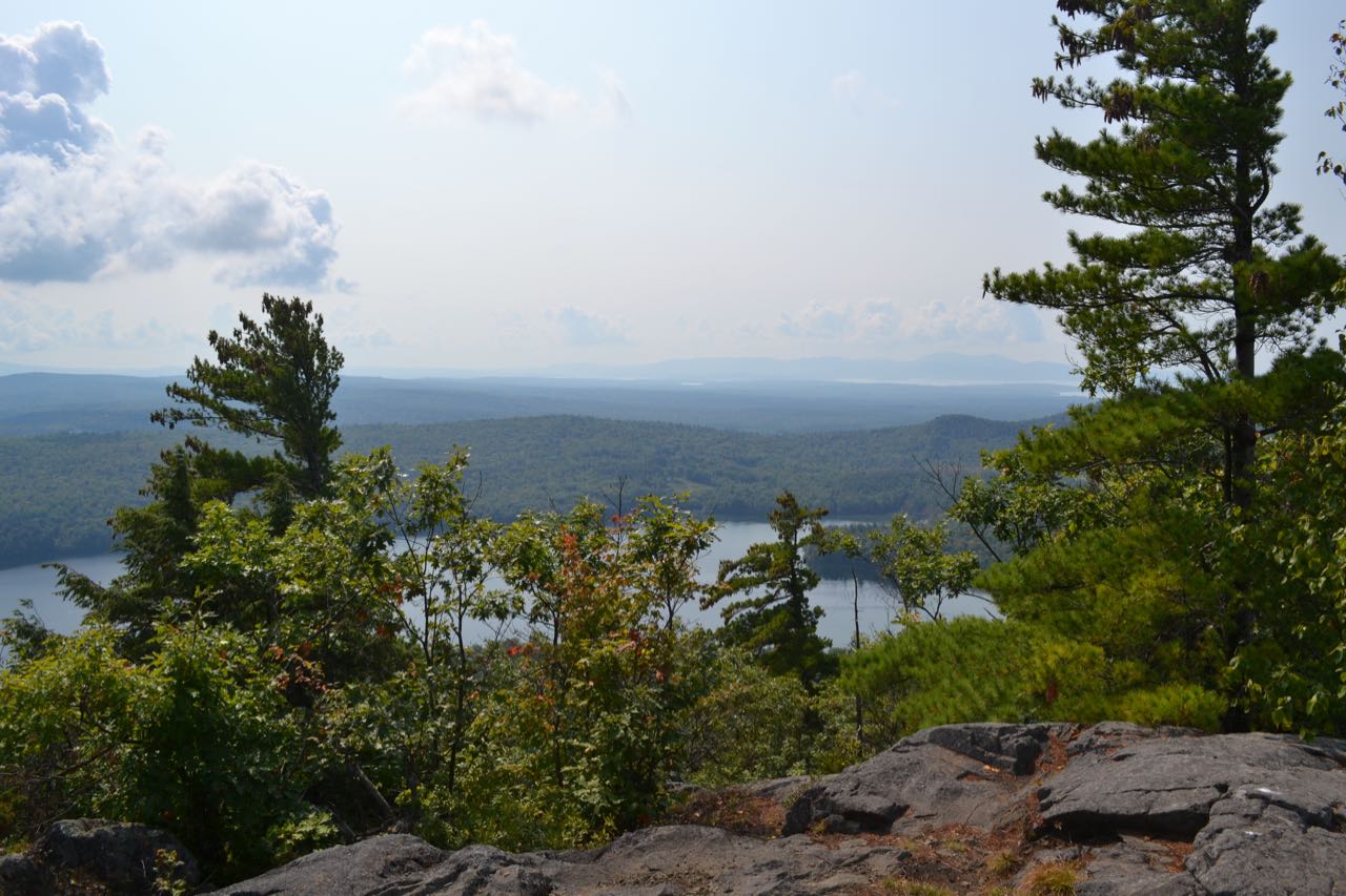
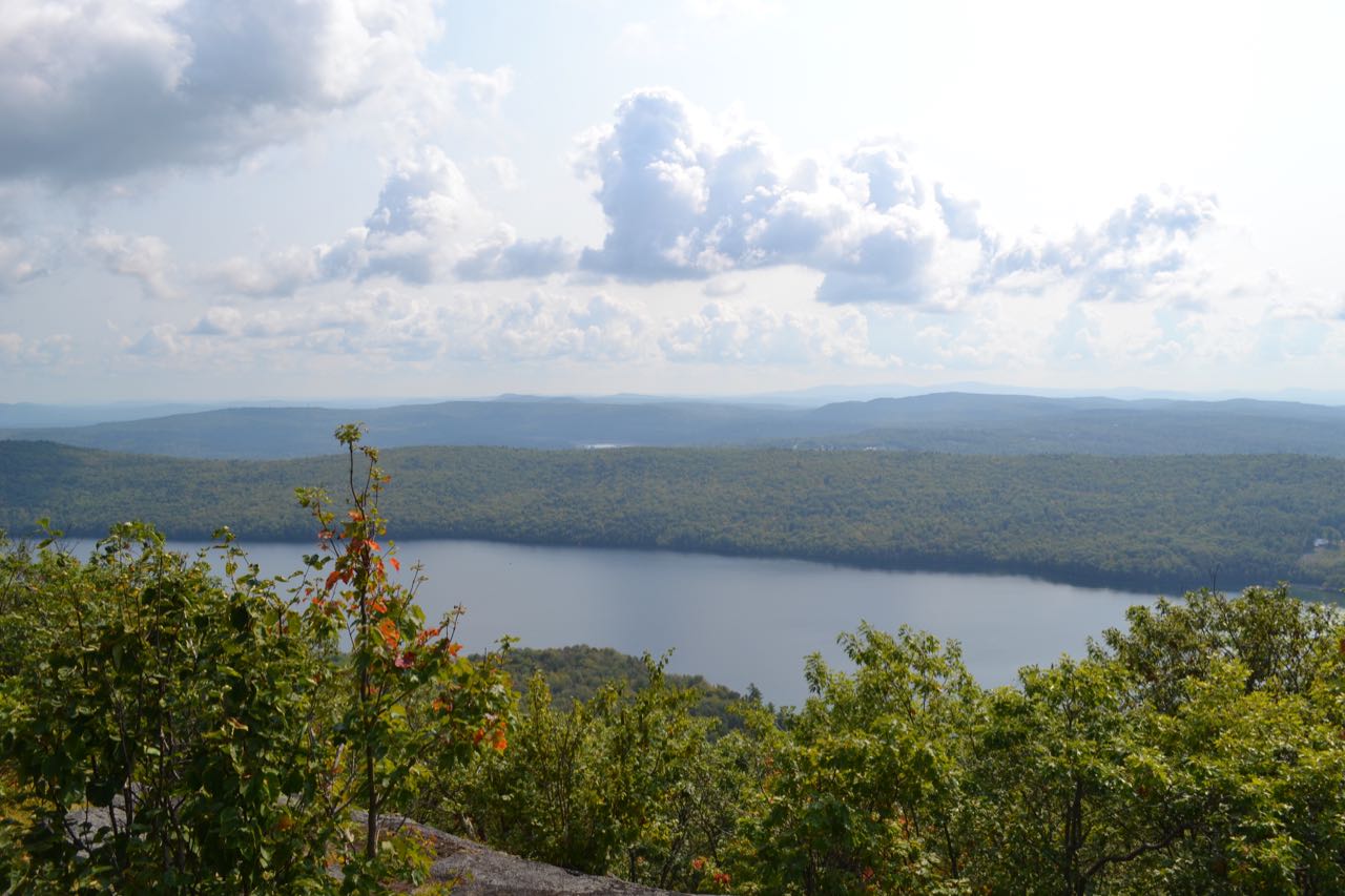
From the parking area, continue up the dirt road on foot for 0.05 miles and turn left onto Mountain Trail at a pair of signs. The trail begins ascending easily and is blazed and occasionally marked with "MT TRAIL" signs. The trail surface eventually becomes rockier for a bit, then the trail climbs up and intersects a logging road. Bear left onto the road for 250 feet, then bear left off the road onto a narrower forest path. The trail climbs uphill moderately along the base of a recently logged area for 0.2 miles. It then encounters a very steep, rocky slope and goes directly uphill for 0.1 miles to emerge on the ledgy summit of Sentinal Mountain. From here, there are good views over the trees down on Dan Hole Pond and out toward Lake Winnipesaukee and the Belknap Range. The forested summit of Canaan Mountain rises nearby. Views are improved by standing on one large boulder perched on the summit. Through an opening in the trees to the north, you can see Mt. Chocorua in the distance.
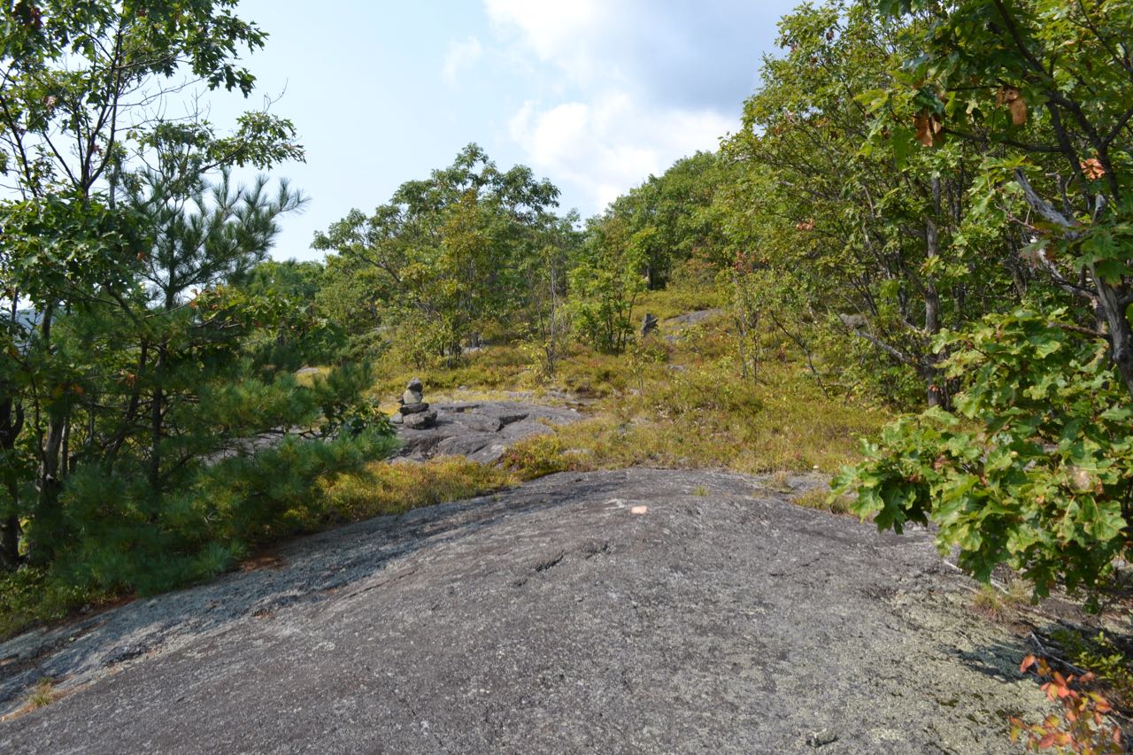
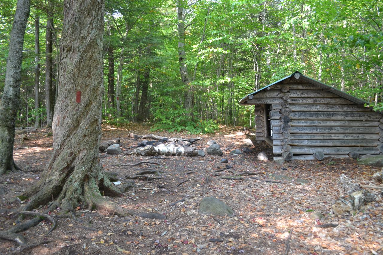
To continue your hike, follow the orange blazes of the Sentinal Connecter Trail off the west side of the summit (from where you came up, to the right). The trail drops quickly off the ledges and leads downhill into a col in 0.1 miles. It then climbs uphill gradually for 0.3 miles through open forest glades. The trail is well-blazed, but the footway may be obscure in this section. It comes out onto open ledges at a turn in the ridgeline from Sentinal Mountain to Canaan Mountain. The trail crosses the ledges, where it is marked by cairns and blazes. From the opening, sometimes called the Merrovista Ledges, you have a much clearer view to the south and a better view to the southeast, including the distant Moose Mountains. At the far end of the ledges, the trail ends at an unmarked intersection with the Dave Green Trail. Turn right and follow the path for 0.1 miles across a flat area to a log shelter. Bear left to continue onto Canaan Mountain Trail, which begins at this point where Dave Green Trail ends. It is well-marked with red blazes, but again, does not receive much use and may not be clear. The trail heads gradually up, then down along the side of the ridge toward Cannan Mountain for a quarter mile and crosses a small drainage. It soon swings left and descends to reach a small, rocky brook crossing in another 0.15 miles, to the south of the summit of Canaan Mountain. It climbs up a for a bit through very bouldery forest, then runs flat for a while. In 0.2 miles from the brook, it makes an abrupt left turn and descends. Watch carefully for the turn, which can be missed easily. It drops down for 0.1 miles and swings right, skirting the edge of a logged area. Continue descending for 0.1 miles in the vicintity of logging to the end of Canaan Mountain Trail near another log shelter by an old twisted tree. Just beyond the shelter, turn right onto Mt. Flagg Trail, which is blazed in yellow and is easier to follow. The Mt. Flagg Trail climbs steadily through a very rocky area with young tree growth for 0.3 miles to reach a flat area between Mt. Flagg and Canaan Mountain, where there are grassy, forested ledges with an abundance of pretty lichens. The trail goes back into the forest, passing through open, fern-filled areas, climbing gradually toward more ledges. In 0.2 miles, it swings to the left and climbs more steeply for 0.2 miles, soon coming out onto open ledges with increasing views, to an open rocky knob just east of the Mt. Flagg summit.
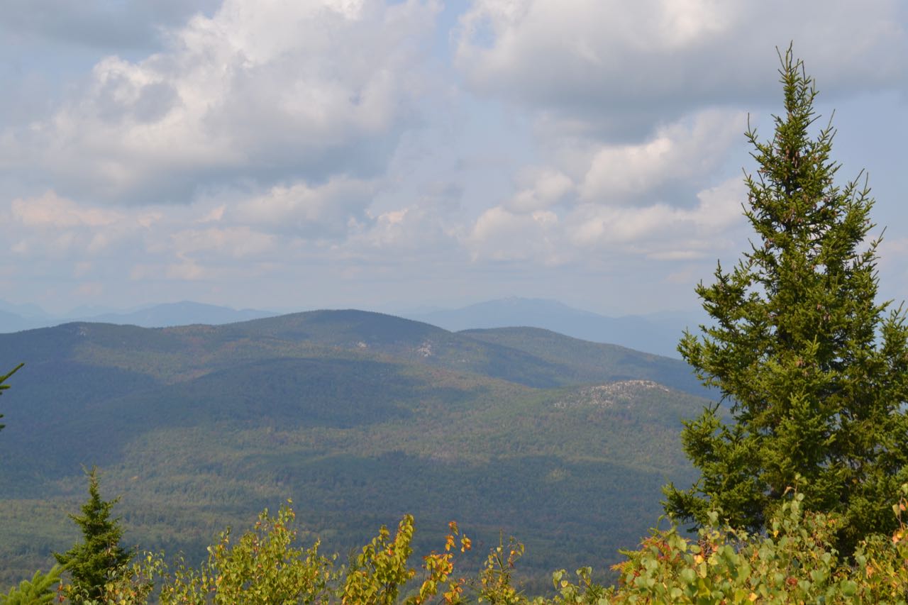
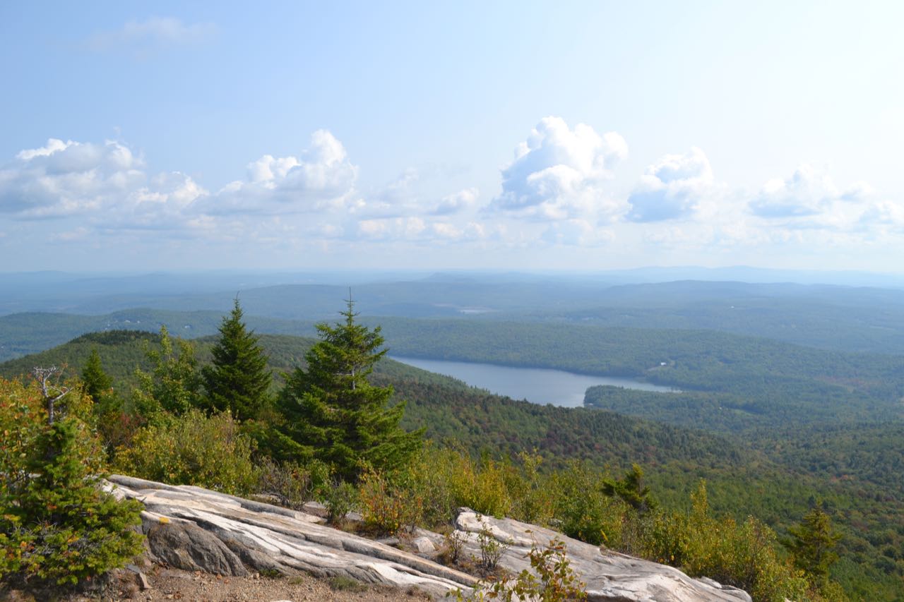
The knob has panoramic views of the Lakes Region. Lake Winnipesaukee and the Belknap Range are seen over Big Ball Mountain, to the left of looming Mt. Shaw. To the southeast, you look back along the ridge you traversed toward Dan Hole Pond and the Moose Mountains. You can see a great distance to the east toward Maine. To the northeast, Green Mountain rises to the right of Ossipee Lake. These terrific views are the highlight of the journey, but you'll want to continue to the true summit of Mt. Flagg for more views. The trail swings to the right over the ledges, crossing the highpoint of the knob and dropping down into the forest. It climbs easily along the ridge for 0.2 miles to the summit, where there are views of the White Mountains from a brushy opening. The Sandwich Range stretches out behind Bald Mountain in the northern Ossipees. Mts. Whiteface and Passaconaway are seen to the left of Bald Mountain, with Mt. Tripyramid and Mt. Osceola behind and further to the left. Just on the left side of the Bald Mountain summit is Mt. Paugus, with Mt. Carrigain and Carrigain Notch in the far distance to the left. Just on the right of Bald is the pinnalce of Mt. Chocorua. Over the trail ahead, you again see the mass of Mt. Shaw, highest peak in the Ossipees.
Printable directions page